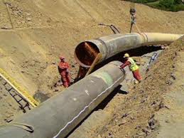
Based on the Route sketch of the proposed Pipe line, the Pipe line Survey will be carried out by using Total Station Survey Instrument covering the distance of the Pipe line and capturing various Topo Features falling within the corridor of existing / proposed Pipe line route.
The MSL Location and its value provided by the Client will be transferred to the starting point of the Pipe line route to arrive at the existing Levels. Based on it, the spot Levels along the proposed Pipe Line Route will be taken by using the above Instrument/Auto Level Survey Instrument. If required, the levels beyond the side ends for a suitable width along the Pipe Line Route will also be taken.
However, if MSL value is not available at the nearby location (though it is a must), an assumed bench mark value at 100m, or as the case maybe, will be taken at the Starting Point of the proposed Pipe Line Route and fix the value on any Permanent Structure. Based on this value, temporary Bench Marks (TBM) along the alignment route of the Proposed Pipe Line will be established and fix its respective value.
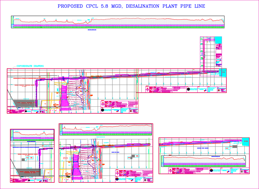
Longitudinal and Cross Sections of the entire Pipe line route at a suitable interval will be taken and it will be shown on the relevant Pipe line Survey Drawing.